
When you survey a village field, paths used by people, cattle, and carts must be marked clearly on the ground and in the FMB. Wrong width or wrong type (footpath vs cart track) creates disputes later. Use these standard field rules unless a competent order or older map shows a different notified width.
1. What you are demarcating
| Type | Typical use | Default max width |
|---|---|---|
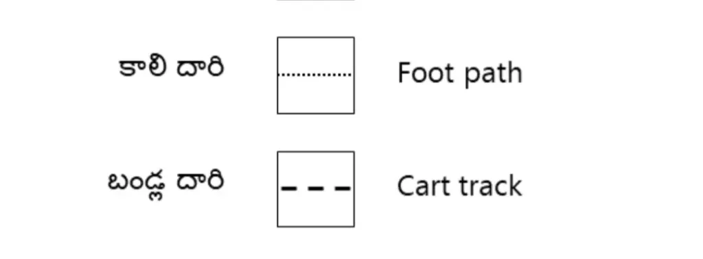
| Footpath | Access for farmers, labour, and cattle on foot | 4 feet (about 1.22 m) |
| Cart track | Access for carts / light vehicle traffic | 10 feet (about 3.05 m) |
Always name the feature in the field book as footpath or cart track — do not leave it as a vague “path”.
2. Footpaths — field rules
- Maximum width: 4 feet, unless a higher width is already fixed in older records or by order.
- Path between two fields: each adjoining owner leaves 2 feet (half the width) from their side.
- Path wholly inside one field: that owner provides the full 4 feet.
- Plant or fix marks so the path is recoverable later; note offsets from the G-line / chain line as for any bend.
3. Cart tracks — field rules
- Maximum width: 10 feet by standard practice for demarcation.
- Track wholly inside one field: full 10 feet from that field.
- Track between different owners: each side leaves 5 feet.
- Do not treat a cart track as a footpath in the sketch — wrong type affects area and enjoyment.
4. What to write in survey records
- Type: “Footpath” or “Cart track” (not “road” unless it is a notified road).
- Width: measured width on ground; if old documents omit width, apply the defaults above and note “standard width adopted”.
- Who bears the width: one field or split between two (2+2 or 5+5).
- Continuity: where the path enters/leaves the survey field (junction stones or chainage + offset).
5. Field checklist
- Walk the path with both adjoining parties if possible.
- Decide type from use and existing maps — not from one party’s wish alone.
- Measure width at representative places; record the adopted width.
- Show the path on the sketch with the correct symbol / note.
- Enter chainage and offset of bends in the FMB like any other boundary feature.
6. Common field mistakes
- Calling every access a “road” on the sketch — roads may be poramboke or notified; footpaths and cart tracks are different width classes.
- Taking the full path width from one owner when the path sits on the common boundary (should split 2+2 or 5+5 unless records say otherwise).
- Omitting chainage/offset of path bends — the path becomes unrecoverable after cultivation.
- Using local “custom width” without writing it in the book when it differs from the standard maximum.
7. How paths interact with area
Path width reduces cultivable enjoyment on the parcels that bear it. When you compute holding area for settlement or mutation, show the path as a separate feature or deducted strip as your office practice requires — do not silently absorb a 10-foot cart track into net area without a note. Cross-check extents with the land area calculator after plotting.
8. Dispute handling (surveyor role)
- Produce FMB / village map evidence of the existing path type and width if any.
- Walk the ground with both sides; note actual use (foot only vs cart).
- Measure and book; do not decide title or easement rights alone.
- Escalate enjoyment conflicts through the revenue chain — survey records geometry, not ownership.
Related tools: FMB bends distance calculator · Links / feet converter · Cadastral principles
Corrections & questions
These guides are maintained for practising AP surveyors. If a step is outdated or wrong, tell us — we prioritise field corrections.
Comments are not stored on this page. The report form attaches this URL automatically.