
Square-paper (grid) area is a quick graphical check when you already have a scale-drawn sketch. It does not replace chain survey or coordinate area for final records, but it is useful for office verification and teaching.
1. What you need
- A sketch of the plot drawn to a known scale (e.g. 1:1000).
- Transparent or overlay square paper (graph paper). Example grids often use 5 mm squares.
- The ground area represented by one small square at that scale (see below).
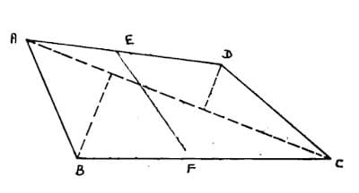
2. Area of one small square
If the map scale is 1 : S (one unit on paper = S units on ground), and each grid square has side d on paper:
Ground side of one square = d × S.
Ground area of one square = (ground side)².
Example (common teaching case): scale 1:1000, square side 5 mm = 0.005 m on paper.
- Ground side = 0.005 × 1000 = 5 m.
- Area of one square = 25 m² = 0.25 are (since 1 are = 100 m²).
Always recompute this for your scale and grid size — do not memorise one number for all sketches.
3. Method
- Place the square paper over the scale sketch so the plot sits fully on the grid.
- Count whole squares completely inside the boundary.
- Estimate part squares along the boundary: group fragments that together make whole squares (or count halves/quarters carefully).
- Total squares ≈ whole + equivalent whole from parts.
- Area = (total squares) × (area per square at that scale).
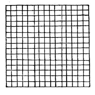
4. Worked example (two parts of a field)
Sketch scale 1:1000, area per small square = 0.25 are.
- Overlay the grid on part ABFE. Suppose whole squares ≈ 43 and part squares ≈ 6 whole-equivalents → total 49 squares.
Area(ABFE) = 49 × 0.25 = 12.25 ares. - Move the grid to part EFCD. Suppose total squares ≈ 53.
Area(EFCD) = 53 × 0.25 = 13.25 ares. - Whole field ≈ 12.25 + 13.25 = 25.50 ares.
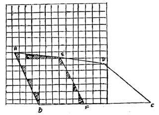
Compare this total with area from chain measurements or coordinates. Large differences mean scale error, bad counting, or a wrong sketch scale.
5. Practical tips
- Work in good light; mark counted squares lightly so you do not double-count.
- For long thin fields, split into two or three overlays (as in the example).
- Never use square paper as the sole basis for mutation extent without confirmation by measurement.
6. When square paper is appropriate
- Teaching juniors how scale relates ground area to paper squares
- Rough office check of a hand-plotted FMB or layout sketch
- Quick comparison of two alternative partition lines on the same scaled drawing
It is not appropriate as the sole basis for mutation extents, court exhibits, or settlement accounts without independent measurement.
7. Common errors and how to avoid them
| Error | Effect | Fix |
|---|---|---|
| Wrong map scale assumed | Every square has the wrong ground area | Read scale bar / stated scale; recompute area per square |
| Double-counting edge squares | Area too high | Mark counted squares lightly; recount once |
| Ignoring partial squares | Area too low | Group fragments carefully into whole-equivalents |
| Skewed overlay | Boundary misaligned with grid | Align a long straight side to grid lines when possible |
8. Better methods for final area
- Triangulate the plot from measured sides and diagonals: land area calculator.
- Use UTM or lat/long vertices from GNSS/TS: coordinates area calculator.
- Reconcile register vs plotted extents: RSR/FMB area error adjuster.
Related tools: Land area calculator · Coordinates area calculator · Dividing a plot of land
Corrections & questions
These guides are maintained for practising AP surveyors. If a step is outdated or wrong, tell us — we prioritise field corrections.
Comments are not stored on this page. The report form attaches this URL automatically.